Map of the four islands
The Habomai Islands, Shikotan Island, Kunashiri Island, and Etorofu Island are east of Hokkaido. Let's look at the four northern islands on the map.

Habomai Islands
skip to Habomai Islands places- lead text
- A paradise of marine resources beyond the Nemuro Peninsula
- Description
| category | name | description | latitude, longitude |
|---|---|---|---|
| Nature | Horses on Shibotsu Island | The islands of Shibotsu and Taraku used to have many pastures where cows and horses were kept year-round. | North 43.5100905 East 146.143055 |
| Nature | Coast of Taraku Island | On Taraku Island, at the northeastern end of the Habomai Islands, most islanders made a living by collecting seaweed. | North 43.624178034932 East 146.29506396216 |
| Nature | Wilderness on Yuri Island | Yuri Island is entirely covered with bamboo grass, and there are few trees. | North 43.422900186982 East 146.05042402305 |
| Nature | Zeikomae, Yuri Island | Zeiko Bay has a depth of 6 to 7 m and can accommodate several 30-ton-class vessels. | North 43.421912764453 East 146.07503306406 |
| Nature | Otamoi Coast, Akiyuri Island | Akiyuri Island, a small island with a circumference of 12 km, was called a “paradise of seaweed” in the Habomai Islands. | North 43.371604788342 East 145.99856914814 |
| Life | Ruins on Shibotsu Island | Shibotsu is the largest of the Habomai Islands, and some pre-war buildings still remain. | North 43.48904 East 146.10702 |
| Life | Tool artifacts on Suisho Island | Everyday tools and facilities that recall the lives of Japanese people remain everywhere on the island. | North 43.43721526 East 145.9169769 |
| Cemeteries | Kafenotsu Cemetery on Shibotsu Island | Shibotsu Island has Japanese cemeteries at Kafenotsu and Nishiuratomari, and in other areas. | North 43.533744898941 East 146.20060416566 |
| Cemeteries | Furubetsu Cemetery on Taraku Island | Taraku Island has Japanese cemeteries at Furubetsu and Hirariusu, and in other areas. | North 43.62431129886 East 146.32854496003 |
| Cemeteries | Tokoma Cemetery on Yuri Island | Yuri Island has a Japanese cemetery near Tokoma-saki. | North 43.421449641344 East 146.05894191597 |
| Facilities | Lighthouse on Kaigara Island | Kaigara Island, located 3.7 km off Cape Nosappu, has a lighthouse that was built by Japan in 1937. | North 43.396034119248 East 145.85830719169 |
Shikotan Island
skip to Shikotan Island places- lead text
- This island full of alpine plants features beautiful hills and lakes.
- Description
| category | name | description | latitude, longitude |
|---|---|---|---|
| Nature | Anama Beach | Cliffs line the northwestern coast of Shikotan Island. | North 43.833496405526 East 146.71938059178 |
| Nature | Mt. Shakotan | The 413-m-high Mt. Shakotan is the highest mountain on Shikotan Island. | North 43.869755986991 East 146.8575547203 |
| Nature | Inemoshiri Bay | The cost here typifies the beautiful scenery of Shikotan Island and is known for a bathing beach frequented by Russians who now live on the island. | North 43.798345 East 146.825095 |
| Life | Townscape of Anama | Anama is home to the government that exercises jurisdiction over Shikotan Island as a whole, as well as to schools, hospitals, fishery processing plants, and power generation facilities established with humanitarian support from Japan. | North 43.828820541199 East 146.75023395786 |
| Life | Townscape of Shakotan | The town of Shakotan has kindergartens, schools, churches, fishery processing plants and apartments. | North 43.870715245362 East 146.82981565522 |
| Cemeteries | Shakotan Cemetery | Shikotan Island has Japanese cemeteries at Shakotan and Inemoshiri, and in other areas. | North 43.874160768016 East 146.82954425048 |
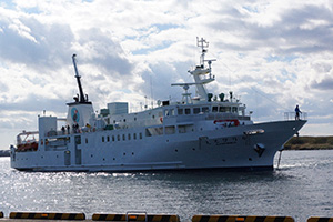
| Facilities | Anama Bay | A new pier entered service here in 2012, and the Etopirika, a ship used for the exchange program of the four islands, can dock at that pier. | North 43.830396648078 East 146.73908333267 |
| Facilities | Anama Culture Hall | The Culture Hall is a center for exchanges with residents, and other activities are conducted with Anama Elementary and Junior High School in the exchange program for the four islands. | North 43.827943725306 East 146.7491371421 |
| Facilities | Shakotan Bay | Shakotan has a border guard facility, and Shakotan Bay is a military port for guards. | North 43.870147109883 East 146.81968968633 |
| Facilities | Russian Orthodox Church (Shikotan Island) | A wooden Russian Orthodox Church stands on a hill overlooking Shakotan Bay. | North 43.870649986628 East 146.83434296761 |
| Facilities | Shikotan Arena | This was the first sports facility to be built for residents of Shikotan Island. | North 43.873787951155 East 146.82817484283 |
Kunashiri Island
skip to Kunashiri Island places- lead text
- Volcanic island with Mt. Chacha, the highest peak of the four northern islands
- Description
| category | name | description | latitude, longitude |
|---|---|---|---|
| Nature | Zaimokuiwa rock | Zaimokuiwa is associated with a legend in which a large stone bridge connected the Shiretoko Peninsula and Kunashiri Island. The surrounding coast is a rugged, rocky stretch. | North 44.024382902879 East 145.67543424625 |
| Nature | Rosokuiwa rock | Rosokuiwa is called “the devil's finger” locally for its towering appearance. Cows graze in the surrounding area. | North 44.071300781317 East 145.87405371304 |
| Nature | Mt. Chacha | This active volcano (1,772 m in elevation) is a beautiful mountain that symbolizes Kunashiri Island. Yezo spruce, Sakhalin fir and other conifers grow in clusters at the foot of the mountain. | North 44.352946084796 East 146.25119054448 |
| Life | Shopping districts | The towns of Shakotan and Furukamappu are lined with colorful shops that sell food and daily necessities. | North 44.0322335149 East 145.84791096936 |
| Cemeteries | Furukamappu Cemetery | Kunashiri Island has Japanese cemeteries at Furukamappu and Chikappunai, and in other areas. | North 44.031282469065 East 145.85846289033 |
| Facilities | Furukamappu Port | Furukamappu Port was so shallow that large ships could not dock, but in 2012, a new quay was built, allowing large ships to enter the port. | North 44.028659959293 East 145.85212101925 |
| Facilities | House of Friendship | The House of Friendship between Japanese and Russians (accommodations and an emergency shelter) was established in 1999 with emergency humanitarian relief from Japan. | North 44.0322335149 East 145.84791096936 |
| Facilities | Culture Hall | The Culture Hall, which was built in 2013, is a complex with a large hall and a gym. | North 44.0322335149 East 145.84791096936 |
| Facilities | Afalina sports and health facility | Afalina, which was built to promote the health of the islanders, is a modern facility with a gym and a swimming pool. | North 44.0322335149 East 145.84791096936 |
| Facilities | Russian Orthodox Church (Kunashiri Island) | This Russian Orthodox Church was completed in 2012. | North 44.0322335149 East 145.84791096936 |
| Facilities | Mendeleyevo Airport | This new airport terminal was completed in 2011. | North 43.95676 East 145.6677647 |
Etorofu Island
skip to Etorofu Island places- lead text
- Japan’s northernmost island, which is the largest after Japan’s four main islands
- Description
| category | name | description | latitude, longitude |
|---|---|---|---|
| Nature | Mt. Chirippu | Mt. Chirippu (elev. 1,582 m) is a beautiful active volcano with a wide base. | North 45.3385541 East 147.9134411 |
| Nature | Oyo Bay | Grasslands extend around Oyo Bay in the southwestern part of Mt. Chirippu. | North 45.279799095213 East 148.01983993236 |
| Nature | Bira Coast | The Bira Coast, with its steep granite cliffs, is a famous scenic spot. | North 45.267547412769 East 148.24603089872 |
| Nature | Mt. Hitokappu | Etorofu Island is home to high mountains, such as Mt. Nishi-hitokappu (elev. 1,629 m) and Mt. Hitokappu (elev. 1,215 m). | North 44.8650143 East 147.4106896 |
| Nature | Rakkibetsu Falls | North 45.516850093762 East 148.88804795208 | |
| Life | Townscape of Shana | Shana is home to schools, hospitals, hotels, restaurants and shops, as well as the government of the Kurile district, which exercises control over Etorofu Island and other islands north of it. In 2011, the main roads in the town were paved. | North 45.227917145596 East 147.87790389057 |
| Life | Parks of Shana | There are flower beds in parks in the residential area. | North 45.227957073872 East 147.87796820281 |
| Cemeteries | Shana Cemetery | Etorofu Island has Japanese cemeteries at Shana and Bettobu, and in other areas. At Shana Cemetery, gravestones had toppled, but they have recently been restored. | North 45.230376117238 East 147.87603148886 |
| Facilities | Nayoka Bay | Nayoka Bay was once famous as a whaling base. | North 45.257448782509 East 147.88088109401 |
| Facilities | Salmon and trout hatchery | Etorofu Island has been well known for salmon and trout fishing since before the war, and it has a large hatchery. | North 45.21815314648 East 147.89384632235 |
| Facilities | Fishery processing plant | This is a fishery processing plant of Gidrostroy on the island. | North 45.267492324728 East 148.02729652696 |
| Facilities | Odaibake Hot Spring | Like Kunashiri Island, Etorofu is a volcanic island with many hot spring facilities. | North 45.220440315816 East 147.86506991564 |
Habomai Islands
- Nature:
- Cemeteries:
- Facilities: